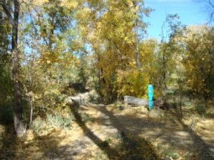
Recreation Areas


Trails

CONTACT

Contact:

  • Trails/Natural Parklands Coordinator
  • 928- 777-1590

Responsible Recreation: AOT has collaborated with outdoor recreation management agencies at the federal, state and local levels to create Responsible Recreation Across Arizona, a one-stop resource with guidelines on enjoying spectacular Arizona landscapes while adhering to COVID-19 physical distancing guidelines.

The latest responsible recreation updates include statewide fire safety and restriction information plus guidance on summer recreation in the state’s deserts. With so many Arizonans turning to the outdoors as a great escape, it’s critical to approach these activities with a protective mindset, as these agencies remain committed to keeping all public lands open and accessible while protecting staff and visitors. This resource is updated regularly and can be shared with Arizonans and visitors alike.

Newsletter

YTA SUMMER 2020 Newsletter

Report an issue on the trails

Trails App

The City of Prescott provides a trails map via the Avenza Map app. 

After downloading the app, you can download a spatially referenced version of the map using the following link.

Download the Trails Map

How You Can Contribute to the Trails System

About the Greater Prescott Outdoors Fund

Mile-High Trail System

The Mile-High Trail System contains approximately 100+ miles of trails including Rails-to-Trails projects along the former Santa Fe Railroad, the Prescott Circle Trail System, the Greenways Trails System and the Dells trails around Watson and Willow Lakes. The Prescott Circle Trail is a network of trails that encircle all of Prescott. The Greenways Trails are urban trails along Granite and Miller Creeks that run through downtown Prescott.

Map # Trail Name Mileage Low Elevation High Elevation Usages Trail Map
Acker Park 1.5 mi. 5630' 5480'
Aspen Creek .8 mi. 5600' 5500'
Badger Mountain 4.04 mi. 6064' 5514'
Butte Creek 1.3 mi. 5788' 5508'
Centennial 2.0 mi. 5729' 5447'
Community Nature Center 1.5 mi. 5640' 5520'
Constellation 2.74 mi. 5229' 5016'
Dells Bonanza 1.89 mi. 5574' 5161'
Embry Riddle-Jan Alfano Trails 2.35 mi. 5276' 5162'
Flume Canyon, Watson Dam and Northshore 2.4 mi. 5186' 5057'
Goldwater Lake 1 mi. 6000' 5980'
Granite Dells Estates 1.78 mi. 5173' 5041'
Granite Gardens 1.5 mi. ' '
Greenways Trail System 1.5 mi. 5336' 5300'
Headwaters 3.27 mi. 5214' 5048'
Lakeshore 2 mi. 5220' 5160'
Lakeside aka Fishing Trail and Explorer 1.1 mi. 5178' 5158'
Longview 1.78 mi. 5547' 5419'
Lower Granite Creek Discovery .8 mi. 5188' 5158'
Over the Hill .4 mi. 5194' 5076'
Pioneer Park 9 mi. 5480' 5220'
Prescott Circle Trail 56 mi. 6680' 5160'
Prescott Lakes and Vista Park 5 mi. 5470' 5200'
Prescott Peavine National Recreation 6 mi. 5220' 5160'
Rancho Vista .6 mi. 6052' 5680'
Rodeo Grounds .5 mi. 5477' 5412'
Storm Trails mi. ' '
Stricklin Park mi. ' '
    Sundog to Lowes Hill mi. ' '
    Watson Lake Loop 4.79 mi. 5237' 5075'
    Watson Woods 1.5 mi. 5218' 5188'
    Willow Dells Slickrock Loops 3 mi. 5180' 5080'
    Willow Lake Loop 5.7 mi. 5225' 5073'

    Trails Video

    Take a look at the video below for an overview of some of the latest trails to ride and hike in Prescott.

    Check out the new Dells Slickrock Trails!
    via Ken Bennet’s fun helmet cam video

    Trail News

    Check out the items below to see how Prescott trails have made the news.

    Other Maps

    TrekAbout Hiking

    TrekAbout Hiking can now be found under Programs and Special Events